
- California Assembly OKs highest minimum wage in nation
- S. Korea unveils first graphic cigarette warnings
- US joins with South Korea, Japan in bid to deter North Korea
- LPGA golfer Chun In-gee finally back in action
- S. Korea won’t be top seed in final World Cup qualification round
- US men’s soccer misses 2nd straight Olympics
- US back on track in qualifying with 4-0 win over Guatemala
- High-intensity workout injuries spawn cottage industry
- CDC expands range of Zika mosquitoes into parts of Northeast
- Who knew? ‘The Walking Dead’ is helping families connect
Typhoon Maysak set to make landfall on S. Korea’s southern coast


Typhoon Maysak was barreling toward South Korea on Wednesday, putting the country on high alert over what was forecast to be one of the most powerful typhoons in years.
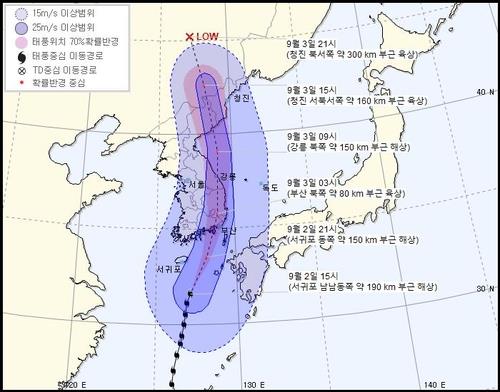
The typhoon was moving at 19 kph over seas some 190 kilometers south of Seogwipo in Jeju as of 3:00 p.m., according to the Korea Meteorological Administration (KMA). Its maximum wind speed was 45 meters per second.
Maysak was forecast to make landfall between Busan and Geoje at around 1:00 a.m. Thursday before moving northward to the country’s eastern coastal regions. It was then expected to travel to North Korea before downgrading near the North’s eastern city of Chongjin on Thursday night.
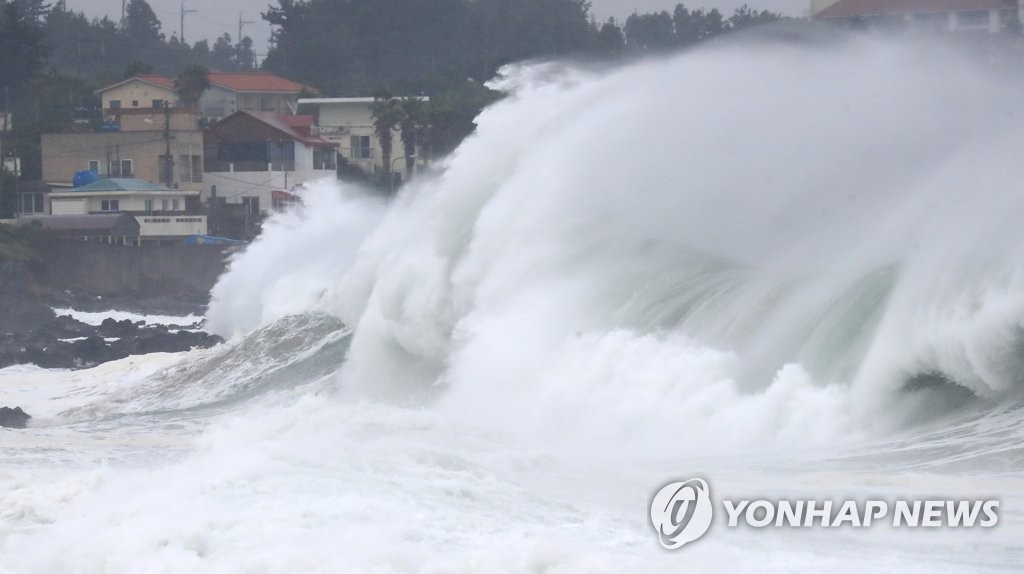

Strong waves are seen at Seogwipo, Jeju, on Sept. 2, 2020. (Yonhap)
The agency said that Maysak may be more powerful than Typhoon Bavi that hit the country last week and was expected to follow a similar route as Typhoon Maemi, which left 131 people dead or missing and 4.2 trillion won (US$3.5 billion) in damage in 2003.
The weather agency forecast the typhoon would affect the country’s southern and eastern coastal areas while pouring heavy rains and bringing strong winds in the inner land area as well.
Heavy rain was expected in the areas, with rain of more than 400 mm soaking Jeju and parts of the country’s eastern coastal regions, such as Gangwon and North and South Gyeongsang provinces.
The weather agency also issued a heavy rain alert for all of Seoul Wednesday evening.
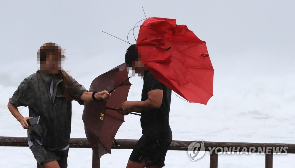
Maximum wind speed was forecast at up to 50 mps near Busan and maximum wind speed of 33 mps was predicted. A wind speed of 40 mps can topple big rocks and moving vehicles.
With the typhoon approaching the country, a typhoon warning has been issued for seas surrounding Jeju, the south coast, southern waters of the West Sea and the East Sea as well as parts of South Jeolla and Gyeongsang provinces.
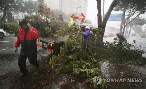
Strong winds measuring 28 mps hit areas in Jeju and the southern coastal region, with heavy rain accompanied by lightning and thunder observed in Gyeongsang.
Power was disrupted at more than 7,000 households in Jeju, as strong winds damaged power cables.
The warning was expected to be expanded across the country, including the greater Seoul area, on early Thursday.
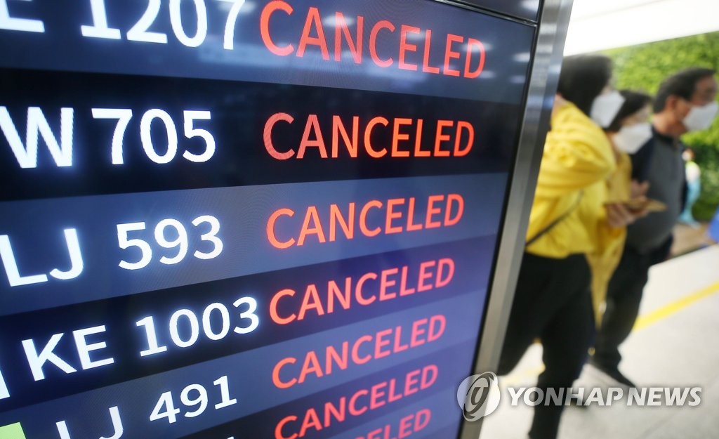
More than 400 domestic flights, including 180 scheduled to depart from Jeju, have been canceled at airports across the country, according to Korea Airports Corp.
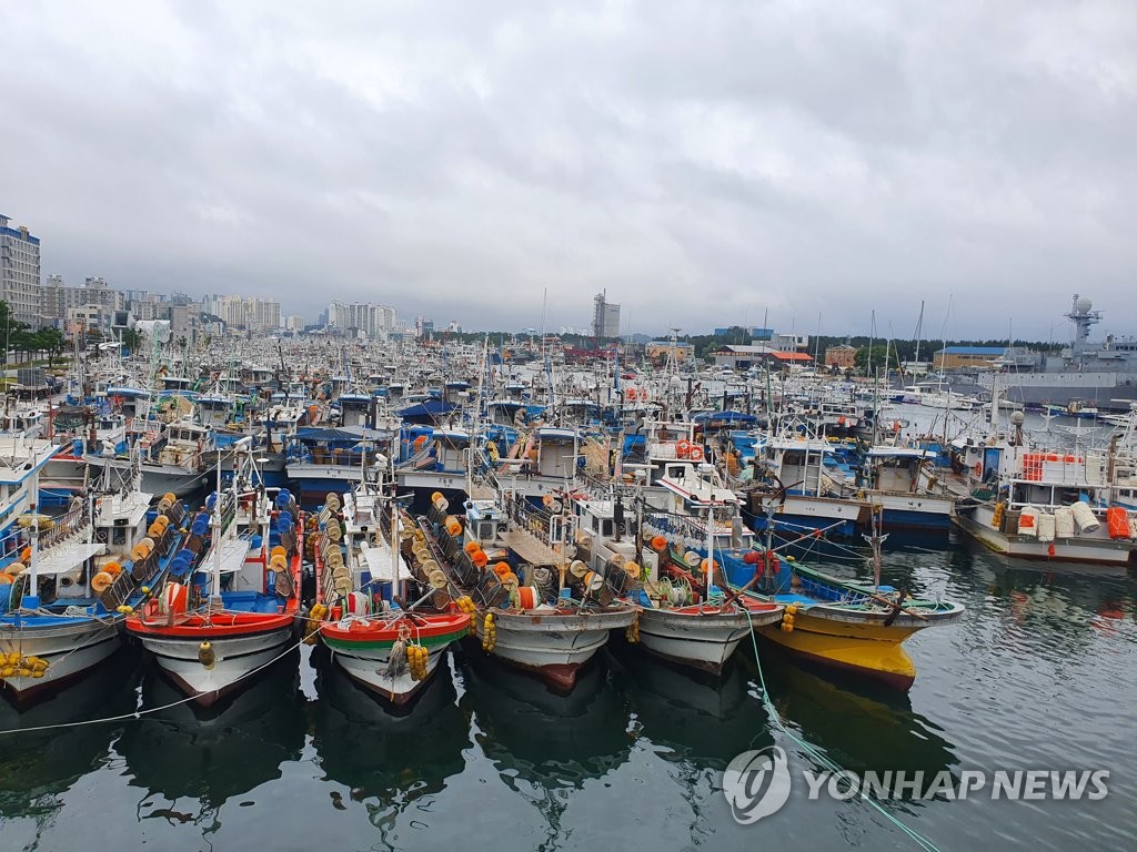
Thousands of ships in coastal areas have evacuated to port cities to brace against the storm. The coast guard has designated parts of seas south and east of the peninsula as danger zones and restricted ships from operating on affected routes.
Jeju’s Cheonjin port was submerged in water while strong wind toppled a street tree, damaging cars parked nearby. Including this, a total of 52 instances of damage have been reported in the island.
Some education offices in affected areas advised schools to reschedule classes or run classes online due to safety concerns.
The regional governments of South Gyeongsang Province, Busan and Ulsan went into an emergency response mode, bracing for the arrival of the typhoon.
In addition to Maysak, the season’s tenth typhoon, Haishen, was also moving northward from waters northwest of Guam at the speed of 22 kph. Via Japan, the typhoon is forecast to reach the South Gyeongsang Province next week.
Showers were expected across South Korea over the weekend due to the typhoon.

-
 Special counsel attempts to bring in ex-President Yoon for questioning
A special counsel team investigating former President Yoon Suk...
- July 14, 2025
ENTERTAINMENT
-
 NCT Dream to drop studio album with time-travel concept
Nicknamed a “storytelling powerhouse” for its ability to craft...
- July 14, 2025
-
 BTS’ agency to unveil new boy group next month
BigHit Music, the agency behind global K-pop acts such...
- July 14, 2025