- California Assembly OKs highest minimum wage in nation
- S. Korea unveils first graphic cigarette warnings
- US joins with South Korea, Japan in bid to deter North Korea
- LPGA golfer Chun In-gee finally back in action
- S. Korea won’t be top seed in final World Cup qualification round
- US men’s soccer misses 2nd straight Olympics
- US back on track in qualifying with 4-0 win over Guatemala
- High-intensity workout injuries spawn cottage industry
- CDC expands range of Zika mosquitoes into parts of Northeast
- Who knew? ‘The Walking Dead’ is helping families connect
SoCal temperatures could be near record levels by Valentine’s Day


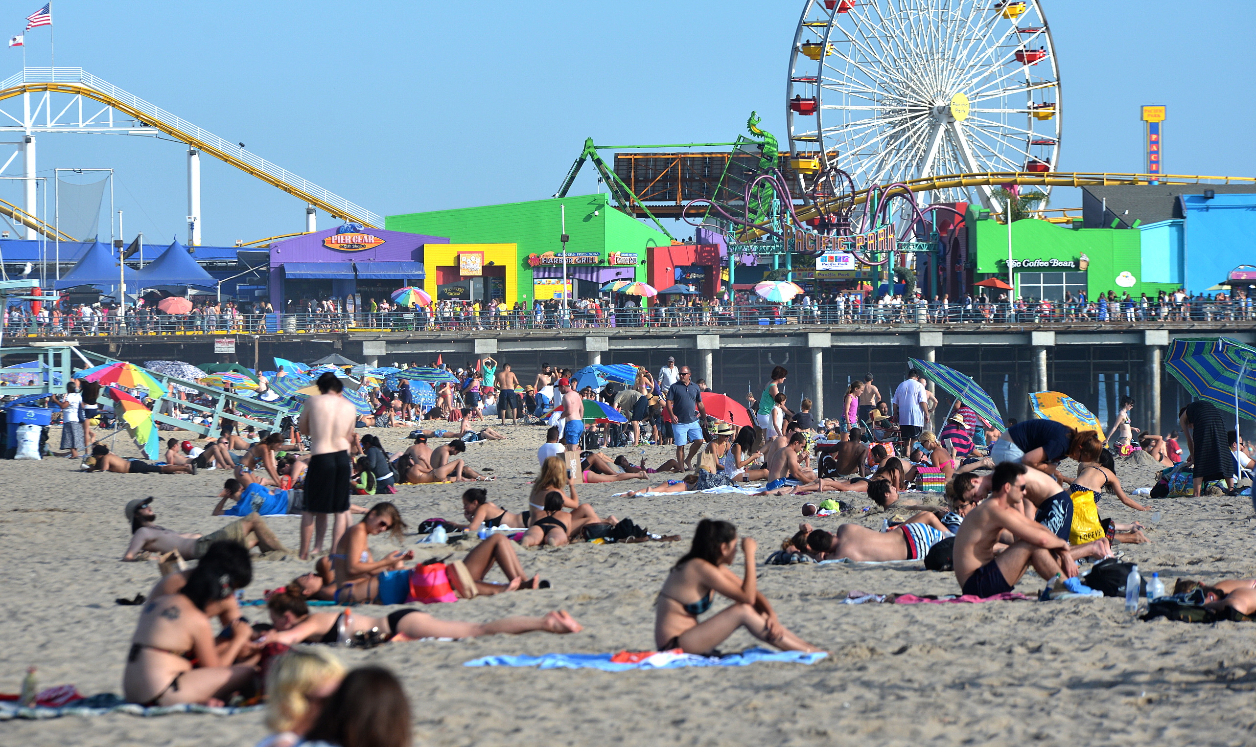
Stuart Seto, a weather specialist with the National Weather Service in Oxnard says visiting the beach on Friday or Saturday “would be an excellent idea.” (Korea Times file)
LOS ANGELES (CNS) – A combination of Santa Ana winds and dry weather conditions will make for a hotter-than-usual week leading up to Valentine’s Day, with temperatures expected in the 80s across most of the area.
“It looks like starting Wednesday, temperatures will really jump up,” Stuart Seto, a weather specialist with the National Weather Service in Oxnard, told City News Service. “The hottest temperatures will be Thursday, Friday and Saturday.”
Seto said the temperatures could be near record levels by Valentine’s Day, noting that average temperatures for this time of year are generally around 67 in downtown Los Angeles.
“It’s going to be about 20 degrees higher than normal Friday and Saturday,” he told CNS.
Seto said Santa Ana winds that developed last night will likely redevelop today and continue off and on throughout the week. Dry conditions will also persist through the week thanks to the high-pressure system.
Thanks to recent rains, the windy and dry conditions likely won’t lead to severe fire danger, although some gusting-wind warnings could be issued in select mountain areas, he said.
Seto said visiting the beach “would be an excellent idea,” although temperatures at the coast — while slightly cooler than inland areas — will still be in the lower 80s.
But people should probably go by Saturday, since a roughly 10-degree drop in temperatures is expected Sunday, with another 3- to 4-degree drop Monday.
The high surf that has been attracting surfers to beaches this morning is expected to slowly subside by late this afternoon, Seto said.
Related Posts


-
 (Yonhap Interview) Ex-Pentagon official stresses need for war plan rethink, swift OPCON transfer, USFK overhaul
South Korea and the United States need to revise...
- May 8, 2024
ENTERTAINMENT
-
 ’12.12: The Day’ sweeps grand prize, best film, best actor at Baeksang Arts Awards
Historical film “12.12: The Day” clinched the grand prize...
- May 8, 2024
-
 ADOR to hold board meeting Friday amid dispute with Hybe
ADOR, a sublabel of K-pop powerhouse Hybe, will hold...
- May 8, 2024