- California Assembly OKs highest minimum wage in nation
- S. Korea unveils first graphic cigarette warnings
- US joins with South Korea, Japan in bid to deter North Korea
- LPGA golfer Chun In-gee finally back in action
- S. Korea won’t be top seed in final World Cup qualification round
- US men’s soccer misses 2nd straight Olympics
- US back on track in qualifying with 4-0 win over Guatemala
- High-intensity workout injuries spawn cottage industry
- CDC expands range of Zika mosquitoes into parts of Northeast
- Who knew? ‘The Walking Dead’ is helping families connect
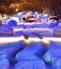
Winter weather advisory issued in L.A. area


(CNS) – A cold low-pressure system that originated in the Gulf of Alaska threatened snowfall at low elevations in the Southland today, prompting the issuance of a winter weather advisory in the San Gabriel Mountains in Los Angeles and Ventura counties.
“Interstate 5 near The Grapevine, along with other mountain roadways above 3,000 feet, will potentially be impacted by snow showers,” according to a National Weather Service advisory, although no disruptions were reported as of early today.
NWS forecasters expect snow showers to taper off late this afternoon.
Between 3 and 6 inches of snow are expected to accumulate above 4,500 feet and between 1 and 3 inches between 3,500 and 4,500 feet, according to the NWS.
The snow level was reported to have dipped down to between 3,000 and 4,000 feet early this morning amid southwest winds of between 15 and 25 miles per hour gusting to 35 mph, reducing visibility as ice formed on some roads combined with a buildup of snow, according to the NWS.
“Use caution while driving,” urged the NWS advisory. ”Check the latest road reports before departing. Keep an emergency kit in your vehicle which includes a flashlight, food and water, extra clothes and blankets and
tire chains.”
Two roads in the Angeles National Forest were shut down at midnight due to a forecast of snow and icy road conditions. The closures were announced by the Los Angeles County Department of Public Works and involve Angeles Forest Highway from Aliso Canyon Road to Angeles Crest Highway and Upper Big Tujunga Canyon Road from Angeles Crest Highway to Angeles Forest Highway.
A winter weather advisory denoting perilous driving conditions is scheduled to be in effect in the San Gabriel Mountains until 5 p.m. The NWS also forecast a wind event from this afternoon until Thursday night, after the precipitation stops. Expected, especially in coastal areas, are westerly winds of between 15 and 25 miles per hour, gusting to 35 mph.
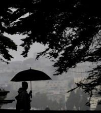
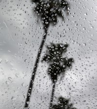
In downtown L.A., the No. 1 lane of the eastbound Santa Monica (10) Freeway was flooded early this morning between South San Pedro Street and South Alameda Street. Heavy rain also was reported in parts of Orange County before 2 a.m.
The NWS forecast highs today of 39 on Mount Wilson; 55 in Palmdale and Lancaster; 60 in San Clemente; 61 in Saugus; 62 in Avalon, San Gabriel and Newport Beach; 63 in Laguna Beach, Anaheim, Fullerton, Pasadena, Burbank and at LAX; 64 in Long Beach and downtown L.A.; and 65 in Woodland Hills. Showers were forecast for all these communities.
Cloudy skies amid similar or slightly higher temperatures were forecast for tomorrow and Friday, with a warming trend expected to get underway along with a return of sunny skies on Saturday.
Related Posts

-
 S. Korea signs framework agreement to provide Ukraine with economic cooperation funds
South Korea has signed a framework agreement with Ukraine...
- April 22, 2024
ENTERTAINMENT
-
 NCT’s Doyoung finds confidence in solo debut after busy year
The past year was a challenging one for Doyoung,...
- April 22, 2024
-
 Ateez member Yunho throws first pitch at MLB match between Dodgers, Mets
Yunho, a member of K-pop boy band Ateez, threw...
- April 22, 2024